 |
| The tower atop St. Regis |
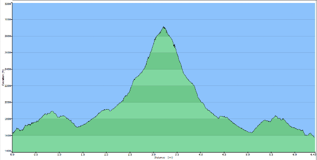
St. Regis Mountain (2865 ft)
Difficulty: Gradual, and fairly steep for the last mile
Date of Summit: 12/15/2010
Trailhead to Summit: 3.4 miles
Trip Time: 4.5 hrs
Ascent: 1266 ft
Temperature: between 5 and 10 degrees F
Last time Martin Heintzelman and I attempted a winter summit of St. Regis Mountain, we had to turn back due to the inability to find the trail and get beyond an area of blowdown. The experience was extremely discouraging, and caused us to keep our distance from that peak for quite some time. Well, on December 15th, 2010 (exactly three years after the first attempt - to the DAY), we decided it was time to give it another try.
 |
| The white stuff |
The snow levels in the park had not been as typical as usual (not nearly as much accumulation), so we made the decision to skip the snowshoes, as there only appeared to be between 4-5" of powder on the ground at the trailhead. While I used
Stabilicers attached to my boots, Martin went sans-spikes, but had the advantage of using the tread of his new
L.L. Bean Cresta's for the very first time. Outfitted in full winter gear, we set out to reclaim our pride from our old foe, St. Regis Mountain.
 |
| Elevation Profile of St. Regis Hike |
 |
| GPS track of St. Regis Hike |
To get to the trailhead,
one parks in a small lot about 2.5 miles down Keese's Mill Rd (which starts near
Paul Smith's College). The trail begins about a tenth of a mile down a private gravel road that crosses a stream. As with many of our outings, we had already made a mistake. After walking for about a quarter of a mile, we realized that we had missed the trail and found ourselves at the gates of
Camp Topridge. After a bit of backtracking, we found the trail register and sign hidden behind a felled tree that was covered in snow. In addition to that small set-back, we found ourselves struggling to find blazes at certain points on the trail (especially in the first mile). The snow's drifting and falling had covered all evidence of human impact from the last time a hiker had been on the trail, four days before. To make it even more confusing, many of the blazes were older, and were WHITE. White blazes might be a good idea in the summertime, but that white blaze is nearly impossible to spot when 97% of your surroundings are covered in fresh, white snow. Luckily, just as our patience was beginning to grow thin, we came across evidence that others had done construction on the trail and added new red blazes as part of the renovations.

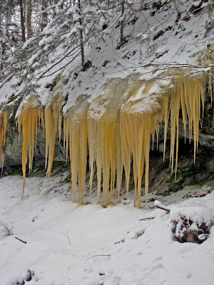
The hike was beautiful. Snow rested on every branch, rock, and needle throughout our trip, dampening the sound all around us to create an experience that felt as if the entire world had been put on "pause" while we hiked up this trail. We passed massive boulders, walked through impressive stands of hemlocks, admired assorted icicle clumps, and relished in the fact that we were the only ones on the trail that day. At about 2.5 miles into the hike, things began to get quite a bit steeper. For nearly the last mile, we steadily climbed up the east face of St. Regis Mountain. With the snow acting as a blanket of padding, it did not feel like the typical, joint-aching "adirondack rock staircase", which caused the ascent to go by much quicker (and less painful). Before we knew it, we were at the top of St. Regis Mountain. Although we didn't have a great view, it felt better to be atop that peak than many of our past victories.
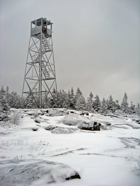 |
| The frostbitten fire tower of St. Regis Mountain |
I'm looking forward to returning to this peak again in warmer weather, as an almost completely bare summit is rare to find on a 2800 ft peak. It also has one of the last fire towers in the Adirondacks, and I'm not sure
how much longer it will actually even be there. The views from this peak are also supposed to be phenomenal, but the cloud cover severely limited our viewing distance. I was also hoping to use a nifty new booklet that I received as a recent present -
Thatcher's Adirondack Peak Finder - which allows one to easily identify what they see from atop a handful of popular peaks in the park. We decided not to eat our lunch on the summit - although a tradition of many a hiker, the windchill was just too much. We trekked back down the trail until we found a sizable boulder that would shelter us from the wind, and enjoyed a lunch of meat and cheese sandwiches, hot tea, and gatorade slushies (again, thanks to the chilly temps!).
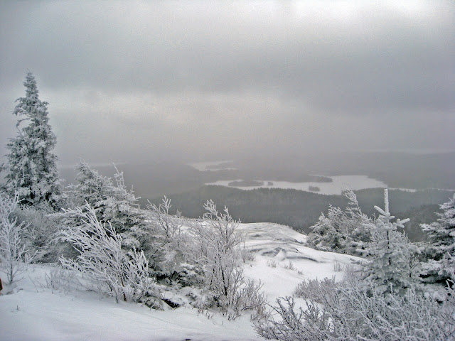 |
| Looking down on the frozen St. Regis Pond from the summit |
The trip back to the car was uneventful and relatively easy. Almost 4.5 hrs later, we once again stepped onto the snowplowed road and headed for the car. It was a wonderful return to such a great backcountry experience, and actually making it to the top made it all the more sweet. We celebrated our victory at the Riverside Bar in
St. Regis Falls, a favorite place of mine to enjoy a can of beer (yep, I said can, so be sure to bring your own koozie) after hiking in the area. With St. Regis Mountain finally checked off the list, there's now only one peak that Martin and I have to return to and settle the score with, as a result of the trail conditions being too icy on our last attempt.
Debar Mountain, you're next...
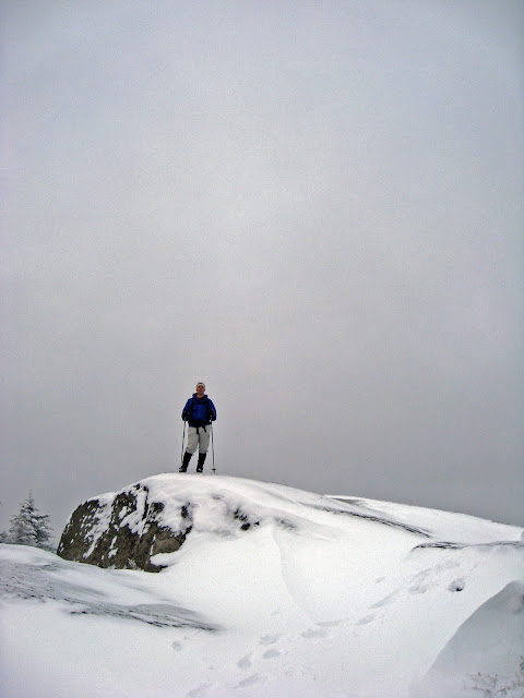 |
| Martin and the great, white, void |


