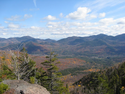
Stone Valley Trail


Byron Bennett at the Racquette River

Stone Valley Trail

Difficulty: Gradual
Date of Hike: 11/26/2008
Loop Distance: 7.5 miles
Trip Time: 4 hrs
Temperature: 30's w/ wintry mix

This trip once again taught me that going "local" is always the best choice - whether it be locally grown food, local businesses with great customer service, or an amazing 7.5 mile just 15 minutes down the road from Potsdam. The Stone Valley Trail takes the hiker along both sides of the of the Racquette River shoreline (3.2 miles on each side with a .9 mile stretch linking them together via a bridge on either end). If you're an amateur geologist, you'll love this hike because of the diversity in the rock types (and informational geology plaques) along the trail. If you're a fan of waterfalls, you'll also love this hike, due to the frequent pockets of cascading water formations that one comes across throughout the hike. If you're a rock lover who enjoys fast moving water, I can't imagine how much this hike would make your day.

The Raging Racquette River

Byron and Cheryl Bennett were visiting us for Thanksgiving. After the treacherous Mt. Jo hike last year on this very same holiday weekend, I wasn't sure if Byron would ever want to take a walk with me in the outdoors again. Luckily, he was very much up for another challenge, so after assessing the weather forecast and realizing that there was a likely chance that the roads to the Adirondacks would be covered with snow/ice, we thought it would be best to stick closer to home.

Two Falls

After parking near downtown Colton (which consists of a bar, a library, and a hair salon), we started our northbound journey along the Racquette River. The first 1.5 miles was packed with great views of the cascading falls, complimented by a gradual foot trail that was a welcome change to the "straight up the mountain" philosophy of the High Peaks region of the Adirondacks. The sun decided to peek through the clouds for a few minutes, only to leave us in an overcast and desaturated wash for the rest of the hike. The middle 4.5 mile portion of the hike found the river at a more peaceful state, as the intensity of Colton Dam's open floodgates had lost their power this far down the river.

The Colton Water Tower

With the Colton Water Tower serving as our beacon, we crossed the river on Brown's Bridge. After a quick (and light!) lunch of powerbars and tortilla chips, we began to follow the river back to Colton, by way of another trail on the other side of the river. This route turned out to be far superior to the first half, as it provided us with amazing views of the Racquette River. Even though we passed many of the same spots on the first half of the walk, it seemed almost as though the rock outcroppings on the second half of the trip existed specifically for us to walk out on them and catch dramatic glimpses of the river's power.

"The Tub"

We ended the trip with a beer at The Finish Line, which turned out to be the perfect end (title and location) to the trip, perched atop the Colton Bridge, overlooking the distant southern rapids of the Racquette. Overall, this trip was quite a surprise - I didn't realize that something so special and majestic could be so close. Just as with Owls Head in the Adirondacks, this will surely be a hike that I frequent with visitors, due to the accessibility, convenience, and sheer "wow" factor it provides.


Owls Head - Short but Sweet


Atop Owls Head

Owls Head (2120 ft)

Difficulty: Easy
Date of Summit: 11/22/08
Trailhead to Summit: .6
Trip Time: 2 hrs
Ascent: 460 ft
Temperature: 'teens

Over this past weekend, we were blessed to have two very good friends visit us. Sarah Miller and Andy Sewell, newlyweds and recently installed east-coasters, drove up from Northampton, MA to spend the weekend with us. It was quite a treat for me especially, for I was unfortunately not able to attend their wedding this past summer out in San Francisco, so this was a wonderful opportunity to catch up with them - and of course - do some hiking! After pouring over the map the night before, Andy and I decided to keep our options open with a few different peaks, and wait to make a firmer decision the following day when we arrived in the high peaks area of the Adirondack Park (near Lake Placid).

Chasm near summit of Owls Head

After dropping off the ladies in downtown Lake Placid (Shopping & Starbucks), we quickly realized that the combination of our late arrival to the region and the relatively early sunset time meant that it would be best for us to shoot for a smaller, shorter peak. We decided on Owls Head, which turned out to not only be the perfect size for our small window of free-time, but a wonderful peak to serve as a taste of the Adirondacks for Andy. The trailhead was about 10-15 minutes outside of Lake Placid, towards Keene, and was nestled back off of a private road, with only a small sign that said "trail" to signify it's location. Upon parking, we immediately set foot onto the trail - Andy in my stabilicer cleats and I with my hiking poles - prepared for the worst snow and ice the mountain could throw at us (Andy was so impressed with the Stabilicers that he purchased a pair of his own at the EMS in Lake Placid, immediately after the hike!).

Overcast but still beautiful

It turned out to be an extremely easy hike. After a climb that seemed to consistently reward us with rock outcroppings and miniature views, we found ourselves near the top much faster than we had expected. Due to the cloudy/snowy day, our views weren't superb, but then again I've always been a fan of those overcast days - the trees and landscape seem to evaporate into thin air as they mix with the fog and clouds in the distance. After a bit of snacking and hydration, we set foot back on the trail for our descent, which was equally simple, providing an overall sense of "relaxation" to this hike that one doesn't always find on an Adirondack trail!

Andy Sewell, atop Owls Head

Overall, the hike was wonderful. I can see myself repeating this hike with many different people, thanks to its relatively short length and great view. After completing the hike, Andy and I both agreed that we needed to do this again - perhaps turning a two-hour hike like this one into a multi-day trip, as it appears that we both have a passion for the outdoors, and there's no better place to feed that passion than in the Adirondacks with good friends!

*Special thanks to Andy for providing the camera and taking most of the pictures!

Me, atop Owls Head

Third Time's a Charm on Mt. Jo


My father, Bill Beck, halfway up Mt. Jo

Mt. Jo (2876 ft)

Difficulty: Moderate
Date of Summit: 10/30/2008
Trailhead to Summit of Jo: 1.2 miles
Trip Time: 2.5 hrs
Ascent: 710 ft

It took me three tries, but I finally took the easy, more enjoyable way up this mountain. Accompanied by my father, Bill Beck, we climbed the back side of Mt. Jo, which was much, MUCH more gradual than the short and steep version that I had experienced in the first and second ascents. After dropping my mother, Kathy Beck, off in the Adirondack Loj for a few hours of serious reading and relaxing in their lounge, my father and I began to tromp through the 6-inch deep snow (that's right - six inches in late October!) towards the trailhead. While we knew that our route would be the longer and more gradual trail, we were still concerned about the snow. As we passed the off-shoot to the short, steep route, we knew that we had made the right decision, for there was not a footprint to be seen on that portion of the trail.

Icicles made of...?

As we slowly climbed around the backside of the mini-mountain, we came across some beautiful icicle formations which appeared, due to their color, to have a substantial amount of iron in them (that's my guess at least). We joked that perhaps this water source was not from a pure mountain spring but perhaps an extremely large animal who just couldn't hold it anymore. We felt lucky to have poles and crampons, for we didn't fall or slip even once on the climb, up or down the mountain. We passed one couple who was resting along the trail, which meant that the duty of blazing the trail through the untouched snow was now our burden, which we gladly accepted. This situation also meant something else - we would be the first people to reach the summit that day, which is always an extra bonus for any hiker.

The clouds rolling over Algonquin

By the time we reached the top, the clouds had left the immediate area, leaving us a nice and open view that could be seen until roughly just before the very top of Algonquin. This allowed for some wonderful pictures (of which we took many, for this was my father's very first Adirondack hike!). As we began to dig into our summit snacks of pretzels and summer sausage, the party we had passed earlier arrived to join us at the top of Mt. Jo. With their help, we snapped a few more pictures and made a call on their cell phone to my mother (we knew that she was worrying about our lives and talking to the ranger about "emergency mountain rescue" at that very moment, just 700 feet below us).

Atop Mt. Jo

Twenty minutes later, we were back on the trail, heading down to my anxiously awaiting mother in the Adirondack Loj. The descent was extremely easy. The six inches of snow made every step feel as if the ground was reaching up with a pillow to cushion your impact, thus easing your joints. Since the temperature wasn't too cold, it was nearly the perfect conditions for a hike in the late (snowy) fall. Having done this mountain three different times now, I can honestly say that it never gets old - the view, the trail, and the company is always changing, which keeps things extremely interesting!

Six inches of snow in October

One Year and Seven High Peaks Later...


Looking down to Keene Valley


Big Slide Mountain (4240 ft) (27th Highest Peak in ADKs)

Difficulty: Moderately Steep
Date of Summit: 10/18/2008
Total Distance Hiked: 9.5 miles
Trip Time: 7 hrs
Ascent: 2800 ft
Temperature: High 40's to Low 50's

It's officially been one year since my first Adirondack hike. A year ago (almost to the day), Martin Heintzelman and I summitted Moose & McKenzie Mountains, which were covered in snow. While there were bets as to whether we'd find snow atop the mountain on this trip, we only spotted ice in a few of the higher regions of the trail. Snow or no snow, Big Slide Mountain was definitely one of the more majestic climbs I've done to date in the park. The fall weather was perfect, the views numerous and constant throughout the ascent, and the morale of the group was high and hopeful.

Peaceful Brook on the Big Slide/Third Brother col

I was invited to accompany Martin Heintzelman and his friend, Greg Peter (who had flown up from Richmond, VA to speak to Martin's MBA students), on a hike in the park. Martin and Greg have been friends since high school, so their hiking history is as long and full of stories as their friendship. While they've backpacked in numerous parks and trails around the country, this was Greg's very first Adirondack High Peak. We arrived in Keene Valley around 10am, ready to hit the trail. As is custom for hikers in Keene Valley, we had planned to park our vehicle near the trailhead, at a parking lot titled "The Garden", that was managed by the town of Keene. Although I had heard stories about the Garden filling up quickly, we were quite suprised to find that it was completely full upon arrival. We had no choice but to park a few miles away at the Marcy Airfield and pay to take a shuttle bus back to the Garden & trailhead.


Just after the First Brother

By the time we finally signed the trail ledger and set foot on the trail, it was roughly 10:30am. Even though we were already a bit behind schedule, it felt absolutely wonderful to be yet again in the thick of nature, where one's mind could wander at the same pace as one's legs and eyes. The climb through the forest was moderate at first, with it picking up in grade as we neared the first of the three Brothers. The Brothers are a series of "mini-mountains" that lead up to the fourth peak beyond the set, which was our final destination - Big Slide Mountain. This hike will forever stand out in my memory, due to the constant view of the Keene Valley region and the Great Range accompanying my left side as I climbed. (The Great Range is my ultimate dream - You climb SEVEN HIGH PEAKS in a 14.5 mile hike, ending at the highest peak in the park (and in New York State), Mount Marcy. Someday it will happen. Someday...)

Martin & Greg, on the steep trail

Over the course of the next three or four hours, we slowly made our way up the spine of The Brothers, eventually finding ourselves in the col between the Third Brother and Big Slide. Just as with previous hikes in the park, we discovered quickly that although the book states that it is 9.5 miles, it was obvious that the distance is based on the map itself - measured as if the trail was flat. When one adds roughly 6,000 feet of elevation change to that as well, a 9.5 mile walk that takes 7 hours starts to make a bit more sense.

Dave, Martin, & Greg atop Big Slide (end of the Great Range in the bkgd)

When we reached the top of Big Slide, we were greeted by a small party of fellow hikers who also took advantage of the perfect weather for a high peak climb. At any given time, there was roughly 10-15 other hikers atop Big Slides relatively small summit, making it feel a bit cramped (but I must say that I do enjoy chatting up the veteran hikers, as they're able to point and label all of the peaks in the distance for me!). We spent roughly 15 minutes atop Big Slide, and it was off to the races again, for we knew that we were running far behind our schedule already, and we now had to consider how much sunlight was left (which meant warmth) so that we could finish the trip in a relatively comfortable (and safe) manner.

Marcy (#1), Colden (#11), and Algonquin (#2) filling the horizon

The descent was a long one. We decided to take a different and longer route on the way down, which dropped 2,000 feet in just over two miles. We then followed Johns Brook along a ledge for the final 3 miles. This route was well worth it though, as it was an extremely peaceful meander through the woods, where you could hear the water rushing through Johns Brook a few hundred feet below. I'm not sure if it was the sense of peace that this area emitted or our tired bodies rationing their energy reserves, but we walked for a few hours without saying a word to one another - it was quite wonderful to spend the final leg of the hike in self-reflection and silence. This was definitely a hike to remember. It was Greg's first high peak, and it was without a doubt one of the more beautiful and visually rich ascents I've done so far. This is one hike that I would do again in a heartbeat - for if nothing else but to stare at that Great Range, because daydreaming about its conquest will never get old.


A View of Giant Mountain (perhaps the next high peak to tackle?)

Autumn Atop Ampersand


Nikki & Joe Gerard on the summit

Ampersand Mountain (3352 ft)

Difficulty: Gradual for the 1st half, Steep for the 2nd
Date of Summit: 9/27/08
Trail head to Summit: 2.7 miles
Trip Time: 3 hrs
Ascent: 1775 ft
Temperature: high 50's

I've finally discovered the perfect hike for out of town guests. Ampersand Mountain. Not too short, not too long, and about as close to Potsdam as one can get if you're shooting for a higher peak to climb with a 360 degree view. Emily's childhood friends, Nikki and Joe Gerard, were visiting this past weekend from Duluth, MN. Since Emily's art show is only a few days away, I had the honor of being the Gerard's "Official Adirondack Mountain Guide" for the day. I knew that they were up for nearly anything, as they both had climbed more than their fair share of peaks out west (Joe is an official "Fourteener", which means that he climbed every peak above 14,000 ft in Colorado!).

The Final Push

Although the forecast said rain, rain, and more rain, we decided to laugh in weather.com's face and start driving down to the trail head anyway. Situated just 12 miles after Tupper Lake on Rt. 3, I was looking for the trail sign and packed parking lot I had always noted while driving to Saranac Lake (which is roughly 8 miles further). Unfortunately, due to the sign being completely gone (it looked like someone actually had taken it off the post...), it took us a few extra minutes and drive-by's to find it. Once we finally found the trail head, we parked in the lot with two other cars, and we were on our way! The best part? Once we stepped out of the car, the rain completely stopped.

Atop Ampersand

For late-September in the park, the weather was quite unique. Due to the cloudy day, there was no sun, the air was cool, and just a bit of humidity lingered from the recent rain. Aside from the presence of water - both in the air and in puddles on the trail, it was perfect hiking weather. We made fairly good time, as the first half of the hike was very easy - a well-manicured, rolling trail - nearly the antithesis of typical Adirondack trail conditions. This was of course because Ampersand was saving the best for last. The last mile of the trail was as steep as anything (well, almost anything) in the Adirondacks. My new hiking companions showed no sign of stopping though, as we pushed steadily upward.

The Cloud Shroud

We reached the summit in very good time - about an hour and a half after we left the car. Due to the cloudy day, we were warned by every hiker who passed us that there was nothing to see but clouds from the summit. When we reached the top, we found ourselves immersed in a giant fog, enshrouding us from all sides and restricting our otherwise 360 degree view of the high peaks. As we began to drop our gear and set-up for a typical "trail lunch" of summer sausage, cheese, and Triscuits, something happened. The air became cooler. The humidity dropped. The clouds had parted! The veil on mountain lifted to reveal a beautiful quilt of early fall colors in the valley below! Although we could not see any of the high peaks in the distance, we were able to get short glimpses of the Saranac Lakes spreading out from the base of the mountain. We had the summit to ourselves that day, only sharing it with the remnants of a fire tower, the plaque remembering Walter Rice - the Hermit of Ampersand, and a vicious looking little spider that seemed interested in our presence atop its rock house. After our well-deserved lunch, we departed for our brisk walk down the mountain. In less than an hour, we were back at our car. It's such a great feeling to discover yet another wonderful peak to climb in the park - and there's no better way to do that than with friends!

Could there be a connection here?

Camping at Cranberry Lake

View from atop Bear Mountain, Overlooking Cranberry Lake

Camping at Cranberry Lake & Climbing Bear Mountain

Difficulty: Easy in camp, but a bit harder hiking the mountain
Date of Trip & Summit: 9/13 - 9/14, 2008
Trailhead to Summit: 1.2 miles
Trip Time: 3 hrs
Ascent: 742 ft
Temperature: Warmer than one would think in mid-September...

The Beck Bivouac next to the Heintzelman Hotel

I can't tell you how nice it is to get away from technology. No computer monitors, keyboards, email, or cell phones. The lack of technology, combined with the beauty of the outdoors and an excuse not to shower, represents a slice of my own personal heaven. Don't get me wrong - I love the email. I love the HDTV. I love the video games. But none of these wonders of the modern world can render the sound of a lapping lake, a hot fire, the taste of marshmallows, or an extremely small tent that causes you to become a claustrophobic insomniac. Ahhh, the joy and wonder of the great outdoors!


Little Martin Heintzelman, Contemplating Life's Great Mysteries...

In all seriousness, Emily and I were extremely fortunate to be invited by the Heintzelman family on their annual fall camping trip to Cranberry Lake. Cranberry Lake campground is located just inside the Adirondack Park, roughly 45 minutes south of Potsdam. It's run by the DEC as a state campground, only one of a few campgrounds like it in the park. Martin Heintzelman had reserved this special campsite (right on the lake, with our own personal beach!) over 9 months ago. The Heintzelman parents, Martin and Louise, brought along their two sons, Martin and Eric. While little Martin has a bit of experience camping and hiking in the great outdoors, this was baby Eric's first overnight outing in the wild!


Baby Eric and his dirty knees!

After arriving at the campsite and setting up our tents (as you can see in the above picture, they were just a teensy bit different in their overall cubic space...), we all decided to take advantage of a lazy, Saturday afternoon. The Martins decided to take the kayak out for a spin around one of the islands on Cranberry Lake. While they were gone, baby Eric got an extra amount of attention from his mom, Emily, and even (surprisingly) me. It wasn't long before he was splashing in the water for his afternoon lake bath. After the Martins arrived back from their boating trip, it was time to head off to the mighty Bear Mountain, our mini-peak to climb for the afternoon.

Coming back from a kayak trip on Cranberry Lake

With little Martin as our guide, we slowly made our way down the trail. All seemed fine, until about 2/3rds the way through the trip - we came to quite a steep pitch in the trail, which appeared to persist until the end of the trail at the top of the mountain. Although it was a struggle for some of us, we all finally made it to the top in one piece, with dad and his "baby backpack" leading the way in the final push.

Heintzelman Family Photo - Before the Big Hike

There was a wonderful view from atop Bear Mountain, as we could see the Adirondack High Peaks in the distance, as well as the expanse of Cranberry Lake, which surprised us with its extensive reach around the many different corners of the park's surrounding topography. After a short rest and photo-op at the top, we quickly made our way back down the mountain, enjoying the views peeking through the trees intermittently throughout our descent.


Emily and me, resting atop Bear Mountain


After a long day of hard work and exercise, it was time for a well-deserved and hearty meal. Thanks to Louise, we had a welcomed surplus of hot chili and cornbread to replenish our energy. The men, having such manly appetites, took advantage of the campfire by cooking some brats and hot dogs as well. Of course, no camping experience is complete without some marshmallows! I actually had the pleasure of being attacked by little Martin and his sticky marshmallow fingers, which made for a good excuse to finally wash some of my clothes!


The Heintzelman Family, saying "Cheeseburger!"


Before bedtime, there were two more activities in which we needed to participate. Little Martin had brought two camping essentials with him on this trip: a deck of (Uno) cards and a book (of Scary Stories). We had a few rousing games of Uno, complete with squeals, screams, and bouts of laughter, all of which successfully (but unfortunately) woke baby Eric, who was sleeping in the tent. After the Uno games, it was time for some scary stories out of Martin's book! We heard "In a Dark, Dark Room" and "The Teeth", both of which we certifiably scary and worthy of being nightmare-inducing for all who were present for the storytime :)


Father and son, taking a load off


Of course, every perfect trip needs to have a rusty lining. That rusty lining came at around midnight, as the rain began to pour down hard, and continued throughout the entire night and into the morning. The rain, combined with the hard ground and the cramped space, did not make for a sound night's sleep for Emily or me. The idea of fitting two people into my tent is practical, but definitely not comfortable. My tent is meant for backpackers, who need the lightest and smallest possible shelter to carry - they are not concerned with space or comfort, because frankly, after a long day of hiking it's easy to fall asleep in a small space. This trip definitely taught me a lesson - if I'm lucky enough to have my wife agree to accompany me on a camping trip (and if you know Emily, that is quite a favor to me...), I should treat her like a queen, pampering her with a spacious abode, much like that of Martin Heintzelman's (for the record, they had two adults, a child, AND a baby in a crib in that freakin' thing - now THAT'S A HUGE TENT!).

Attack of the sticky marshmallow fingers


We woke up early the next morning and broke camp somewhat early as well, due to the rain that was looming in the distance. Overall, it was a wonderful trip - full of laughter, good friends, and great memories, set in a beautiful spot that is probably only one of a handful of ideal settings like it in the world! Thanks for inviting us along, Heintzelmans!

Adirondack Death March


The view from Algonquin, the second highest peak in the park

Wright Peak (4580 ft) (16th Highest Peak in ADKs)
Algonquin Peak (5114 ft) (2nd Highest Peak in ADKs)
Iroquois Peak (4810 ft) (8th Highest Peak in ADKs)

Difficulty: Steep and Strenuous, both up and down
Date of Summit: 8/14/2008
Total Distance Hiked: 13.6 miles
Trip Time: 10.5 hrs
Total Ascent from hiking 3 peaks: 3753 ft
Temperature: Low 70's

Never again. Don't get me wrong, it was an amazing experience, but I'll never go through agony like that again. The problem wasn't that I was attempting three high peaks in one day. It was attempting the three peaks plus both descending via the steepest trail in the park and conveniently running out of water halfway through the trip.

This guy sat next to me during my morning break

If I had been smart, I would have hiked up to the three peaks and returned back down the same way, thus lowering my total distance to a mere 11.6, two miles less than what I ended up hiking. Instead, I followed the exact route that Martin Heintzelman and I had planned to hike on our overnight trip a few months ago (we ended up hiking just Mt. Marshall, the other peak in the MacIntyre Range - see that post for details). This day hike was a big, grueling loop - I would summit the other three peaks in the MacIntyre Range (Wright, Algonquin, and Iroquois), then take the Algonquin-Lake Colden Trail, which sharply drops 2,000 vertical feet from the col near the backside of Algonquin. After reaching the valley near Lake Colden, I would take Avalanche Pass back to the parking area, via Marcy Dam. In my head it was an achievable goal, but by the end of the trip my legs were telling me otherwise.

The 13.6 Mile Death March

I started out at the trail head at 8am, fresh and ready for adventure. The first leg of the trip went by quickly, and before I knew it, I had reached the intersection of the Wright Peak side trail and the main Algonquin trail. I took the Wright Peak side trail, which proceeded to climb another 500 feet over the next half mile. The summit was well worth the last strenuous half mile, as the bald peak was adorned with large trail cairns and had wonderful views of the surrounding area.

Beautiful six-foot tall Cairns on the approach to Wright's summit

Wright Peak has a bit of history to it as well. It was named after Governor Silas Wright, but is also the site of a memorial to four US Air Force officers, who crashed their B-47 Bomber into the mountain in 1962. Supposedly, there is both a plaque memorializing their lives, as well as artifacts from the plane wreckage still atop the mountain. I was unable to find any evidence, so I guess that gives me a good excuse to return for another look sometime soon.

Atop Wright Peak

I noticed a few things while on Wright Peak. First, Algonquin is HUGE. Even standing atop Wright, it loomed another 1,000 feet higher as its head poked up above the clouds. I also realized how puny and pathetic Mt. Jo is from this peak. It looked like a small anthill from 4580 feet up, which makes sense since Jo is only about 2800 feet. I couldn't help but laugh, since I've made the Mt. Jo hike with family members on two different occasions, both in the summer and late fall. It was also amazing to see how far I had hiked from starting at Heart Lake, in just a couple of hours time.

I think I can see my car from here!


From Wright Peak - the mighty Algonquin waits to be conquered...

After a conversation with a fellow hiker and a quick snack, I was on my way again.
I quickly descended the side trail back down to where it meets up with the main Algonquin trail, and promptly rejoined the somewhat steady stream of commuters who were slowly making their way up the mountainside. I hiked for another steep mile, climbing 1,000 feet, and there I was - atop the second highest peak in the park.

Atop Algonquin, Looking down on the Flowed Lands

It was absolutely wonderful. I could see for miles in all directions, wishing that I had the patience to sit down with my map and locate every peak surrounding my position. It was quite chilly on the summit - perhaps high 50's with a decent wind, so one did not sit still for long without having to put on long sleeves. There were probably about 15-20 people on the top of the mountain at any given time, a crowd spanning all ages and hiking abilities.

The Slides of Mt. Colden from Algonquin (Marcy in the distance)

The summit steward was dutifully making his rounds, striking up conversation with as many people he could. Summit stewards are funded by the ADK Mtn Club, Nature Conservancy, and the DEC (Department of Environmental Conservation). The steward hikes up the mountain at sunrise, stays atop all day, and hikes down the mountain at sunset. They stay up there to educate the public on the fragility of the plants in the alpine zone, which is the area above the tree-line.

Atop Algonquin, Iroquois in the distance

I had lunch in my own little quiet corner of Algonquin's summit (it's a tabletop summit almost the size of a football field), with a million dollar view that costs absolutely nothing but a couple hours of exercise. I had already climbed two high peaks today - it was now on to my final peak for the day - Iroquois. I began the descent down the backside of Algonquin, towards Boundary Peak and Iroquois.

The backside of Algonquin, from Boundary Peak

Within 15 minutes of leaving Algonquin's summit, I had already reached Iroquois' summit! I couldn't believe how easy it was to reach this peak! Then I realized something - I was standing on Boundary Peak (this small peak was actually the boundary line between the Iroquois and Algonquin nations, hundreds of years ago) - Iroquois was still a great distance ahead of me! I once again set off for my destination, through a herd trail that was obviously well-used, but extremely narrow and claustrophobic. It was satisfying to reach the summit of Iroquois, because I could finally catch a glimpse of Mt. Marshall, which I climbed a few months earlier. Once again, a peak I had hiked earlier now looked extremely small, looking down from the eighth highest peak in the park.

Atop Iroquois, looking at Mt. Marshall (which Martin Heintzelman and I hiked in June)

After an extremely quick pause atop Iroquois, I backtracked to the col between Boundary and Algonquin. It was the next 1.7 mile stretch that completely broke me. It was 2,000 feet of nothing but vertical drops, consisting of rock face and boulders. Basically, I was hiking in a stream/waterfall bed, and with every step down, my joints and thighs would cringe.

Yep, that's the trail...dropping 2,000 vertical feet over just 1.7 miles

At about 1/3 of the way through this torturous descent, I ran into a couple from Canada. They were having trouble, mainly because the woman's boots had completely fallen apart. The rubber soles had worn away to nothing, exposing the steel shank in each boot as if it were a flapping tongue on its sole. They were planning to hike up to Algonquin and back down to the parking lot, but I convinced them otherwise, as I was really not sure how much further she would make it in those boots and it was starting to get a bit late. That's one thing that I have always taken seriously - your feet should be the one thing that you pamper more than anything else in hiking.

Another trail shot (it doesn't look it, but that is one steep grade...)

It was also about this time that I ran out of water. I had packed two liters of water, but just as I underestimated the size of this hike, I also underestimated my water supply. Luckily, I had potable aqua tablets (iodine tablets) that I used. After dropping one of those tablets into my bottle of fresh stream water, I was once again on my way. When one is that thirsty, they don't mind if the water tastes a bit like a swimming pool.

My emergency water source

I finally got to Avalanche Lake, but I was tired from head to toe and really beginning to worry. My legs (thighs) were so worn out that they would give way with too much weight (so I bore much of that weight on my poles), so I had no choice but to walk straight-legged like a robot for a good portion of the final five miles. To make things worse, I was also once again dehydrated. But this time I was not willing to try the potable aqua, for I just didn't trust the stagnate lake water (I imagined all the Giardia and Cryptosporidium Baddies meeting up down in the lake for a big party, just praying that some stupid hiker with those silly iodine tablets would be desperate enough...).

Beautiful Avalanche Lake (looks much different than two months ago!)

As I stumbled down the trail, weak and cottonmouthy, only one thing could keep me focused on my goal - the drinking water faucet back at the parking lot and the (now necessary) stop I would be making at McDonald's on the way home. I kicked it into high gear and played through the pain (my mom would be proud - I even struck into "I think I can, I think I can..." at one point in my final miles), finally arriving at my car (and that sweet, sweet water) exactly 10.5 hours after I began, at 6:30pm. Exhausted and barely able to walk, I thanked God that I made it back to my car in one piece. My wife thinks I'm crazy for doing that hike, and I'd have to agree with her - it's been over 24 hours since I completed the hike and I'm still barely making it up and down the stairs due to muscle soreness. But I just can't get the mantra out of my head: "6 peaks down, 40 more to go..."